|
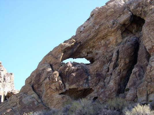
The author and 2 friends drove to northwestern Utah to find an area called "The Devil's Playground". Take I-15 north from Salt Lake City, fork left onto I-84 as far as the town of Snowville. Here, go west on Utah 30/42. After 18 miles, 42 continues straight ahead and 30 forks to the left. Continue on 30 through the town of Park Valley and on to Rosette. Follow 30 27.2 miles west and then southwest from the The Rosette Post Office. Just before arriving at the 27.2 mile point, observe some rock formations on the right. The arch is in these formations. Turn right at 27.2 miles onto a gravel road. Follow this road until a two-rut road turns to the right. The arch is visible from this intersection; but turn right to get closer to the arch. The arch has a span of about 11 feet. The three explorers agreed on the name Devil's Eye. |
