|
From Hwy 163 between Bluff and Mexican Hat, turn north onto San
Juan county Rd.262 at MP 40.5. This turn is about 5 miles west of
Bluff. This is the Lower Butler Wash Rd. Drive this dirt road north for
about 3.8 miles. At this mileage, turn west onto a dirt track and drive to
the edge of Butler Wash. Park near the Wash at approximately UTM 12S
0621395E, 4130614N, WGS 84. Alternately, you could drive south
from Hwy 95 at MP 112.3 onto the Lower Butler Wash Rd. for about
17.2 miles to arrive at the same parking place. Look for the alcove in
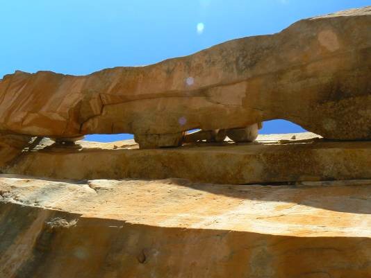
the slanted white Navajo sandstone. Double Stack Arch is in the rim of
this alcove. It is about a 20 minute hike to the arch. The arch is named
for nearby Double Stack Ruin.
Coordinates for the arch are UTM 12S 0620379E, 4130601N, WGS 84 at about 4,860ft. Elevation. Photo and Directions by Rob Jones Rob's Butler Wash Trip Report |
