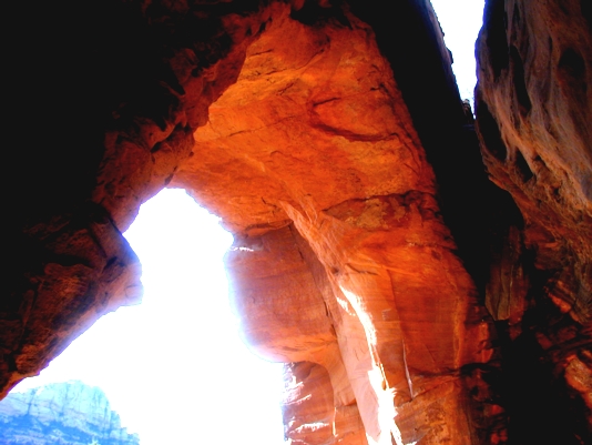
 From the “Y’ (junction of highways 89A and 179) in Sedona, Arizona, drive 1.3 miles SW on 89A (toward the town of Cottonwood) to Soldier Pass Road. Turn right onto Soldier Pass Rd. and drive 1.4 miles to Rim Shadows Drive, then turn right and continue for 0.2 miles. There are low signs pointing the way to Soldier Pass trailhead. Park in the urban lot, and remember to bring a Red Rock parking pass (Forest Service). Start hiking on the way to Soldier Pass, crossing a drainage soon after starting. Hike uphill to a signed junction. The Jordan Trail goes to the right, our trail goes to the left to Devil’s Kitchen (a large sinkhole) in about 100 feet. Here is the tricky part. The slick rock is mutilated, an off-road vehicle trail – do not follow this route. Instead, curve over a low bump of rock alongside the left edge of the sinkhole and you will soon encounter the hiking trail. Hike for about a mile, crossing into the drainage at the end of the ORV road. Continue up the drainage for about a quarter mile (near approx. UTM 12S 428017E 3861984N WGS84) and go right at a “Y” junction (not marked when we visited) up the hill toward the arches that look like alcoves. If you hike too far, the arches will come into view across a low canyon. This is OK, for this is the best area-wide view ( this trail continues to Soldier Pass). Hike uphill, following an old 4wd route, then a trail for approximately a third of a mile to the base of the alcove arches. The UTM coordinates for the arches are approximately 12S 428215E 3862313N WGS84.
|
