|
See Metate Arch for location of the Hole-in-the-Rock Rd. from
which this arch is accessed. Drive down Hole-in-the-Rock Rd.
for 36 miles and turn left onto a dirt road which may be signed
"Fortymile Ridge". Drive 4.3 miles on this road (impassable when
wet) and turn left (N) for 100 yds and park at the top of a bump
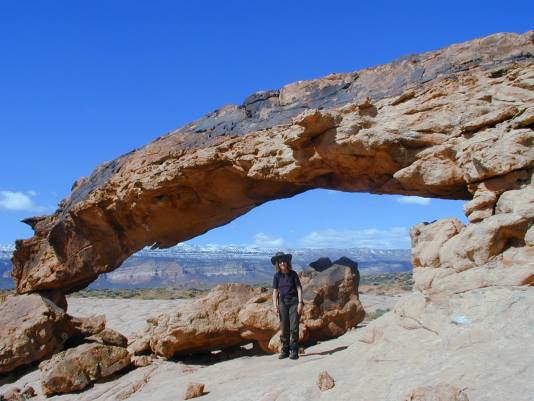
containing a large cattle water tank. This is Fortymile Ridge. With
the right lighting, the arch is visible toward the south from this
location (best seen with binoculars). From this location, it looks
like the prow of the submarine from "1000 Leagues Under the Sea"
(according to Rob). Following a compass heading should get one
to the arch from this location. Rob's directions which follow
will also get one to the arch: " The hike to the arch by this route
is about 1.5 miles. From the parking area at the water tank, hike
back down the road to the Fortymile Ridge Rd. and head E. for
about 0.1 mile to another cattle water tank and a low concrete
cistern. Hike SE toward the red sandstone bump (elev.4772')
about 0.3 miles away (no trail). At the south edge of the bump,
turn south and generally follow the east side of the drainage for
about a mile. Along the way, where the sandy drainage turns to
slickrock, angle up toward the distant Sooner Rocks and scan
the top of the slickrock for the arch. Because of the angle, Moonrise
Arch might be observed first. Sunset Arch is on the west side of
the drainage, but it will be more easily observed by staying on the
east side."
Photo by Rob Jones. |
