 If one continues south on the Scenic Drive, the road
becomes more primitive, crosses Pleasant Creek and parallels
South Draw for four miles before turning west to leave the Park
boundary. Tantalus Flats is in the area just west of the Park
boundary. Somewhere along the way, the road becomes known
as the Lower Bowns Reservoir Rd. and continues west to join the
Boulder Mtn. Highway, Rt. 12. When you reach the center ridge
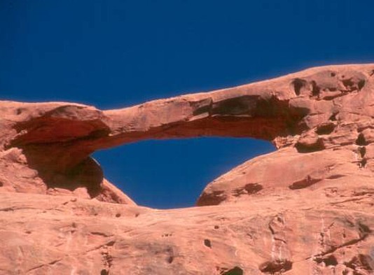
in the Tantalus Flats area, the Flats Rd. turns north. Hike the side
road south along the ridge under Skyline Arch for about a mile.
The ridge drops down somewhat at the south end to an east-west
drainage. Scramble up to the drainage, work your way around the
wall of the ridge, and head north up the side drainage on its west
side to get this view across the drainage in the afternoon. The
arch has an estimated span of 35 ft.
If one continues south on the Scenic Drive, the road
becomes more primitive, crosses Pleasant Creek and parallels
South Draw for four miles before turning west to leave the Park
boundary. Tantalus Flats is in the area just west of the Park
boundary. Somewhere along the way, the road becomes known
as the Lower Bowns Reservoir Rd. and continues west to join the
Boulder Mtn. Highway, Rt. 12. When you reach the center ridge
in the Tantalus Flats area, the Flats Rd. turns north. Hike the side
road south along the ridge under Skyline Arch for about a mile.
The ridge drops down somewhat at the south end to an east-west
drainage. Scramble up to the drainage, work your way around the
wall of the ridge, and head north up the side drainage on its west
side to get this view across the drainage in the afternoon. The
arch has an estimated span of 35 ft.
Photo and directions by
Ted Dahlmann
