 This arch is located in the Needles District of Canyonlands
National Park. The route starts at the Cathedral Butte Trailhead
(see Mastodon Double Arch). Before starting, with binoculars,
look on the top flatish layer of white Cedar Mesa sandstone
toward the bumps in the sandstone below the high cliff point
and the main Salt Creek Canyon. With the right evening light,
Wedding Ring Arch is visible.
It's a six mile, mostly off-trail, hike to the arch, round trip.
Hike down the trail to the top of the white Cedar Mesa sandstone.
At about UTM 6132900N 4201879W , leave the trail to the east,
right, (going down canyon), and walk off-route, staying near the
rim (top of the Cedar Mesa sandstone) to avoid crushing massive
quantities of crytobiotic soil which is very well-developed in this
area. Look at this map to see the general line of travel. You will
see a user-created trail as you near the arch:
See Map. Wedding Ring Arch is at
UTM 12S 611307N 4204104W at about 6500 ft. elev.
Nearby are the two sons of Wedding Ring.
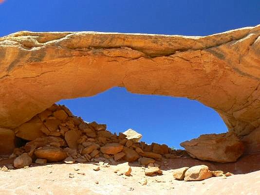
This arch is located in the Needles District of Canyonlands
National Park. The route starts at the Cathedral Butte Trailhead
(see Mastodon Double Arch). Before starting, with binoculars,
look on the top flatish layer of white Cedar Mesa sandstone
toward the bumps in the sandstone below the high cliff point
and the main Salt Creek Canyon. With the right evening light,
Wedding Ring Arch is visible.
It's a six mile, mostly off-trail, hike to the arch, round trip.
Hike down the trail to the top of the white Cedar Mesa sandstone.
At about UTM 6132900N 4201879W , leave the trail to the east,
right, (going down canyon), and walk off-route, staying near the
rim (top of the Cedar Mesa sandstone) to avoid crushing massive
quantities of crytobiotic soil which is very well-developed in this
area. Look at this map to see the general line of travel. You will
see a user-created trail as you near the arch:
See Map. Wedding Ring Arch is at
UTM 12S 611307N 4204104W at about 6500 ft. elev.
Nearby are the two sons of Wedding Ring.
Directions and photo by Rob Jones |
