NABSQNO 12S 369285 4006159 MAP
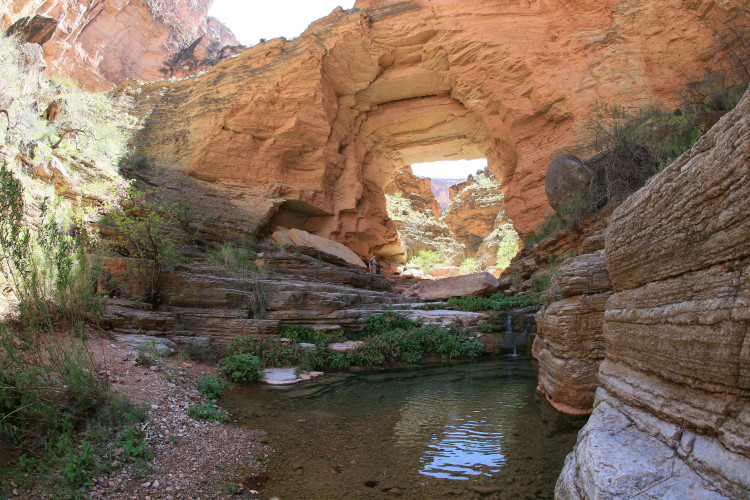
ROYAL ARCH is a natural bridge spanning a perennial creek above Elves Chasm (although not accessible from there). It has a span of 60 feet. Reaching it involves a very difficult multi-day backpack from South Bass and Tonto Trails. The route is shown on the National Geographic Trails Illustrated map of Grand Canyon. Photo by Paul Neiman (see photos and slideshow of his trip here). For scale, notice the group of three people standing just to the left of the opening.
Go to next Gallery feature - Hell Hole Canyon
Return to Grand Canyon Portfolio