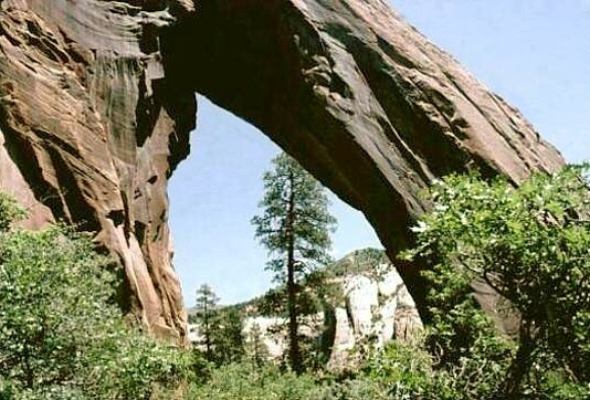
 This arch is located in the Manti La Sal National Forest north
of Blanding. Although the first part of the hike is across private
property, the owner has said that people hiking to the arch and
nothing else do not need permission. The author suggests that
visitors take extra care to respect the owners property. In
Blanding, drive north from the intersection of Center St. (US191)
and 100 East (this is FS 095). At 8 miles, the pavement ends;
at 10.5 miles, stay left; at 11.9 miles, fork left toward Elk Ridge;
at 14.8 miles, turn left onto 4wd road; at 14.9 miles, fork right; at
16 miles, park outside the gate. From the gate, hike 1.5 miles
to the arch; first hiking west around a rock promontory then
across a meadow up-canyon to the northeast. The arch is on
Forest Service land. To view the arch from the road, continue
driving ahead past where the 4wd road starts (at 14.8 miles) . At
17.6 miles (ie, 2.8 miles further) the road takes a sharp right
around a point. At 17.8 miles, stop and look down the canyon for
the arch. The arch is located at UTM 12S 623521E 4185328N.
Directions, courtesy of the Natural Arch and Bridge Society.
This arch is located in the Manti La Sal National Forest north
of Blanding. Although the first part of the hike is across private
property, the owner has said that people hiking to the arch and
nothing else do not need permission. The author suggests that
visitors take extra care to respect the owners property. In
Blanding, drive north from the intersection of Center St. (US191)
and 100 East (this is FS 095). At 8 miles, the pavement ends;
at 10.5 miles, stay left; at 11.9 miles, fork left toward Elk Ridge;
at 14.8 miles, turn left onto 4wd road; at 14.9 miles, fork right; at
16 miles, park outside the gate. From the gate, hike 1.5 miles
to the arch; first hiking west around a rock promontory then
across a meadow up-canyon to the northeast. The arch is on
Forest Service land. To view the arch from the road, continue
driving ahead past where the 4wd road starts (at 14.8 miles) . At
17.6 miles (ie, 2.8 miles further) the road takes a sharp right
around a point. At 17.8 miles, stop and look down the canyon for
the arch. The arch is located at UTM 12S 623521E 4185328N.
Directions, courtesy of the Natural Arch and Bridge Society.
Photo by
|
