|
Mr. Dahlmann approached this interesting span from the NE following a complex route difficult to describe. The following
directions were deduced by the author's examination of the
Spotted Wolf quadrangle map. The author has not used these
directions to visit the arch and does not guarantee success for
anyone using them. The author has visited Black Dragon Canyon
to view the interesting pictographs and had no difficulty going
north from I/S 70 onto a 4wd trail about 0.8 miles west of the bridge
over the San Rafael River. In about a mile, this trail branches to the
left to the mouth of Black Dragon Canyon and branches right, ending at the River in about a mile. From here, it may be possible to hike north, paralleling the river for about a mile and a half, to the confluence of Tidwell Draw at UTM 12S 5526E 43126N (NAD83/WGS84 datum). Hike about 1 1/4 miles north iin Tidwell Draw to a side wash going
west (UTM 55285E 43146N). Hike west in this side wash for about
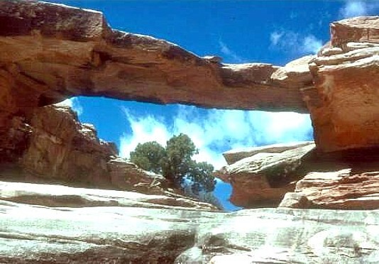
2 1/4 miles to the bridge at UTM 549334E 431535N. The natural
bridge has a span of 31 ft.
Photo and Directions
|
