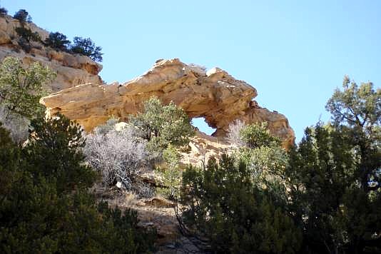
 Trails Illustrated/National Geographic Map No. 712, Revised
2005 shows the trail to Swasey's Cabin Trailhead and Eagle Arch.
From I/S 70, take Exit 131 south. It parallels I/S 70 going west for
two miles before turning south. Turn west onto a 4wd trail just
south of a roadside exhibit and continue west to the Swasey's
Cabin Trailhead. Hike (or 4wd) to Eagle Arch and continue on for
a short distance (perhaps a quarter mile) to Golden Arch high on
the left.
Trails Illustrated/National Geographic Map No. 712, Revised
2005 shows the trail to Swasey's Cabin Trailhead and Eagle Arch.
From I/S 70, take Exit 131 south. It parallels I/S 70 going west for
two miles before turning south. Turn west onto a 4wd trail just
south of a roadside exhibit and continue west to the Swasey's
Cabin Trailhead. Hike (or 4wd) to Eagle Arch and continue on for
a short distance (perhaps a quarter mile) to Golden Arch high on
the left.
Photo by
|
