|
Not to be confused with the “Legbone Arch” in Herdina Park, Arches N.P. To get to this one, go north from Moab on Rt. 191 and turn left onto Rt. 313 which leads to both
Island in the Sky District of Canyonlands N.P. and also to Deadhorse Point State Park-both worthwhile destinations . Turn left where Rt.313 turns left to Deadhorse Point.
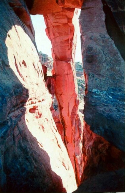
At 1.6 miles from this turn, go east on a graded gravel road for 1 mile, then go north on a graded oil well access road for a quarter mile and turn right for 1 ¼ miles and park. Hike about 2 miles NW to the edge of the Dry Fork of Bull Canyon (a good map and a GPS are a must for this hike). Look for the point where 5 ft.x15 ft. Thighbone Arch is visible along with 8 ft.x 30 ft. Legbone Arch. Thighbone Arch appears face-on in the foreground with the underside of Legbone appearing on edge in the Thighbone opening. On the far-side of the point, there is an 8 ft. drop between two rocky surfaces close together that must be descended to get to the bench below. Follow around east and drop down and back around the point on a talus surface. There is also a third arch associated with these two about 10 feet away called Hipbone. Afternoon provides the best lighting. Photo by Ted Dahlman |
