|
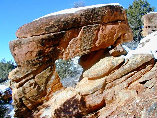
From I/S 15 south of Provo, turn east on Rt. 6 toward Price for about 10 miles.
Turn left onto the Diamond Fork Rd. this turnoff is off the four lane stretch of
Rt. 6 which was rebuilt to bypass a large landslide. Drive 6.9 miles up the
Canyon to the Red Ledges picnic area and then go another 0.2 miles. Look to
the left about 50 ft. above the road and 300 ft. from the road. The span is
approximately 5 ft. UTM 12T 0465936E 4436565N (WGS84).
Photo and directions by
|
