|
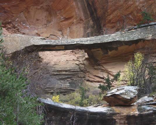
This arch is in the Colorado National Monument near Grand Junction.
It is accessed from the Redlands area rather than from Rim Rock
Drive. From I/S70 take Colorado 340 south at the Fruita exit. Go SW
at South Broadway which curves west at South Camp. Turn left at the
third street on the left (Wildwood Drive). The well-marked Liberty Cap
trailhead is a short distance down Wildwood Drive on the right. Hike about
one mile of the Liberty Cap Trail to where the un-marked unofficial Bench
Trail turns right. This intersection has many logs and rocks to keep hikers
on the Liberty cap trail. Cross these logs and continue on the unofficial
Bench Trail NW for 1.6 miles to the second small side canyon (if this
Canyon is approached from the opposite direction, it is the first canyon
SE of Goldstar Canyon). This canyon has two creek beds. The arch is at
the end of the creekbed furthest southeast, or on the left as one hikes up-
canyon. The UTM NAD83 coordinates in Zone 12 are N4326949
E700483.
Directions and photo by Craig Shelley |
