NABSQNO 16S-570756-3760162
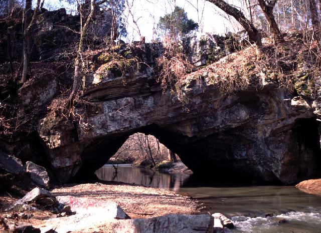
Chandler Natural Bridge, Alabama
Photo by Jay Wilbur
NABSQNO 16S-570756-3760162. Chandler Natural Bridge is an old waterfall natural bridge that spans Little Canoe Creek where it forms the boundary between Etowah and St. Clair counties, Alabama. Although on private land, public use is permitted by the corporate owner. Access is via County Road 35 through Gallant. Use the map to negotiate local roads that lead to the arch.
Chandler Natural Bridge has a span of about 40 feet. There is a small pillar natural arch associated with its northern abutment.
| Topo Map | Google Map | Return to State Index |