NABSQNO 10T-625300-4622740
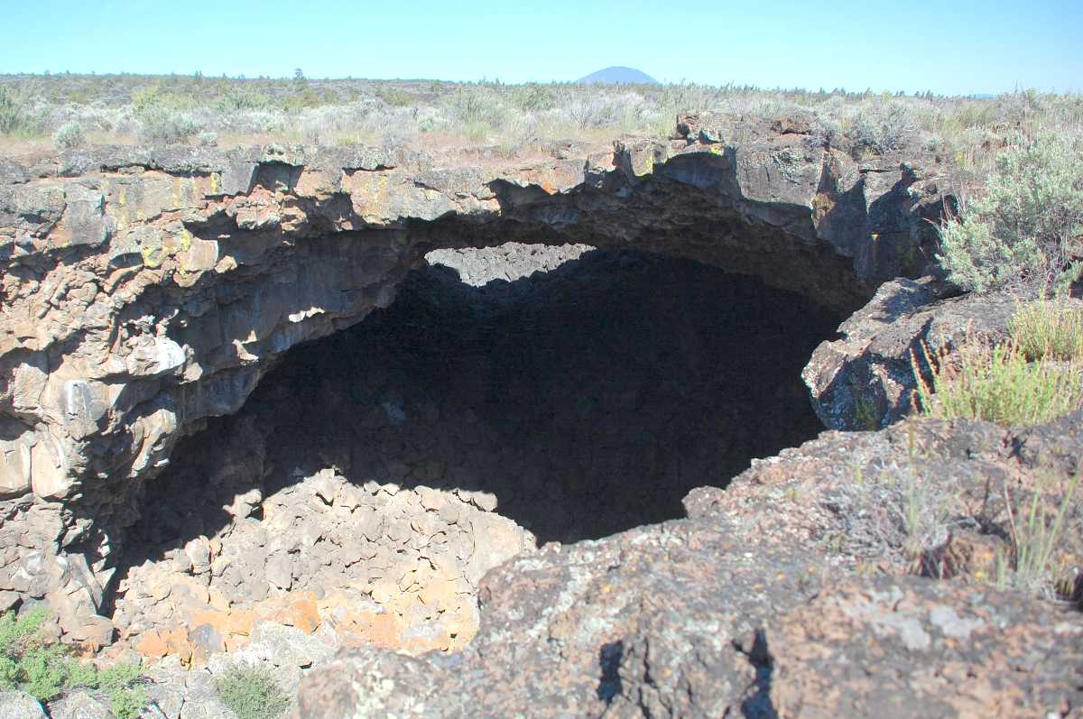
Captain Jacks Bridge, Siskiyou County, California
Photo by Jay Wilbur
NABSQNO 10T-625300-4622740. Captain Jacks Bridge is a lava natural arch that resulted from the partial collapse of the basalt roof of one of the dozens of the lava tubes formed by the Mammoth Crater flow, which occurred about 35,000 years ago. It is located in a designated wilderness area within the Lava Beds National Monument, 1.8 miles northeast of the Skull Cave parking area, in Siskiyou County, California. Most of the tube that formed the arch has been set aside for scientific research, but the arch is still open to the public. Access is by hiking the Lyons Trail, an old park road now closed to all but foot and horse traffic.
Captain Jacks Bridge derives its name from the Modoc Indian leader who held off the U.S. Army for six months in 1873 by establishing strongholds in these lava beds. The Modoc War was the last major Indian War and the only one fought in California. The name Captain Jacks Bridge predates the establishment of the wilderness area and the monument. Before the old Lyons Road was closed to vehicles, a parking area was adjacent to the arch. During the 1950s, a sign with the text "Natural Bridge" was placed there. It was still there in 2011, albeit heavily weathered.
Vreeland listed this arch in his catalog as number 21-2, and reported a span of 40 feet.
| Topo Map | Google Map | Return to State Index |