NABSQNO 12S-685935-4335002
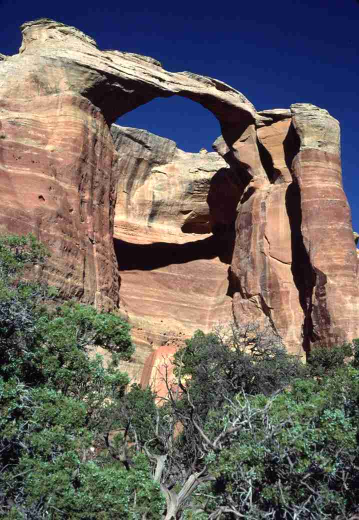
Centennial Arch, Mesa County, Colorado
Photo by Jay Wilbur
NABSQNO 12S-685935-4335002. Centennial Arch first evolved as an alcove, cave, or pothole natural arch, but there is no longer any evidence that clearly indicates which. Because it is obviously old, it is best classified as an arc natural arch. It has eroded through Entrada sandstone.
Centennial Arch is one of several important natural arches clustered above Rattlesnake Canyon on BLM land west of Colorado National Monument in Mesa County, Colorado. This area has often been proposed as an addition to the Monument, and there is much merit in that proposal. Not only is it one of the most scenic examples of canyon country anywhere in the US, the large cluster of natural arches here deserves special protection and management.
Centennial Arch is also known as East Rim Arch, the name given it by Will Minor. However, Centennial Arch is the official name determined by the USGS Board on Geographic Names. Access involves a lengthy and complicated four-wheel-drive route, followed by a somewhat strenuous loop hike of about 3 miles that visits most of the Rattlesnake Canyon arches. A shorter, easy hike to the top of the arch is also an option. It is best to check with the BLM office in Grand Junction prior to visiting this area.
The Vreeland catalog includes this arch as number 18-20. It has a span of about 65 feet.
| Topo Map | Google Map | Return to State Index |