NABSQNO 16T-686030-5080490 (f)
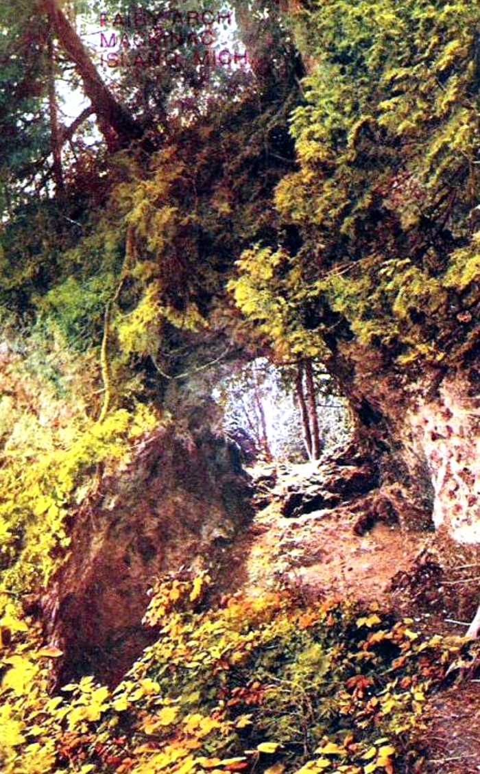
Fairy Arch (fallen), Mackinac County, Michigan
Postcard by an unknown photographer (public domain)
NABSQNO 16T-686030-5080490 (f). Fairy Arch was a sea natural arch that eroded through a limestone promontory on the shore of Lake Nipissing, a predecessor of Lakes Huron and Michigan. Because the lake level dropped significantly in recent times, the arch was left isolated and well above the erosive power of the lake's waves. As a result, Fairy Arch lasted well over 3000 years, an unusually long lifespan for a sea natural arch. In the early 20th century, that longevity was abruptly cut short by man when the arch was intentionally destroyed as part of a road improvement project. Ironically, the road is now off-limits to any motorized vehicles other than emergency vehicles.
Fairy Arch was located near Mission Point on the east side of Mackinac Island, Michigan. Access to its former location is via a ferry from Mackinaw City, followed by a 3/4 mile walk along the paved shore road, the road that led to the arch's demise. Fairy Arch was listed as number 14-102 in the Vreeland catalog. It had a span of about 6 feet.
| Topo Map | Google Map | Return to State Index |