NABSQNO 16U-378910-5334025
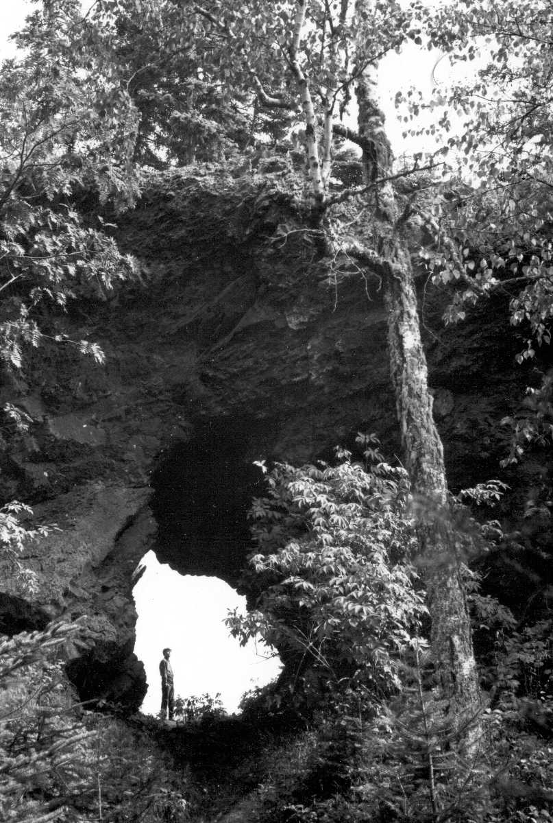
Amygdaloid Arch, Isle Royale, Michigan
Photo by N. K. Huber (USGS file photo)
NABSQNO 16U-378910-5334025. Amygdaloid Arch is a sea natural arch eroded through a ridge of basalt from the Amygdaloid Island Flow, the lowest layer of the Portage Lake Volcanics, a group within the Keweenawan Supergroup. The arch was formed by wave action on the shore of Lake Duluth, a glacial predecessor of Lake Superior. Because the lake level dropped significantly in recent times, the arch was left isolated and well above the erosive power of the lake's waves.
Amygdaloid Arch is located near the center of Amygdaloid Island, Isle Royale, Michigan. Amygdaloid Island is the northwesternmost and oldest of the Isle Royale islands. Its name, and the name of the arch, comes from the many amygdules, cavities that have filled with secondary minerals, found in the basalt here. Isle Royale is a national park and is managed as wilderness. Access usually requires a boat ride to a beach on Amygdaloid Island, followed by a short hike to and along the hiking trail on that island's ridgetop. Isle Royale National Park is closed in winter.
Amygdaloid Arch is listed in the Vreeland catalog as number 14-103. It has a span of about 12 feet.
| Topo Map | Google Map | Return to State Index |