NABSQNO 15S-544565-4080060
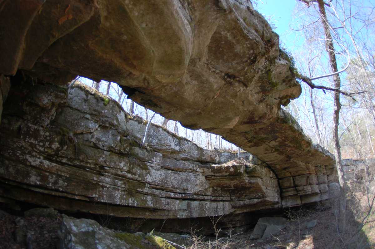
Sweden Fork Natural Bridge, Douglas County, Missouri
Photo by Jay Wilbur
NABSQNO 15S-544565-4080060. Sweden Fork Natural Bridge is a waterfall natural bridge eroded through sandstone by a steep side tributary of Sweden Fork. It is located about 11 miles southeast of Ava, Missouri. Sweden Fork, in turn, is a tributary of Rippee Creek. Much of this watershed has been acquired by the State of Missouri and set aside as the Rippee Conservation Area. However, the arch remains on private land. Fortunately, the owner usually grants permission to view the arch to courteous visitors. Sweden Fork Natural Bridge was listed as number 302 in the second edition of the Beveridge catalog under the incorrect name Lakey Natural Bridge. It has a span of 40 feet.
| Topo Map | Google Map | Return to State Index |