NABSQNO 15S-550020-4300875
Roche Percee Natural Arch, Boone County, Missouri
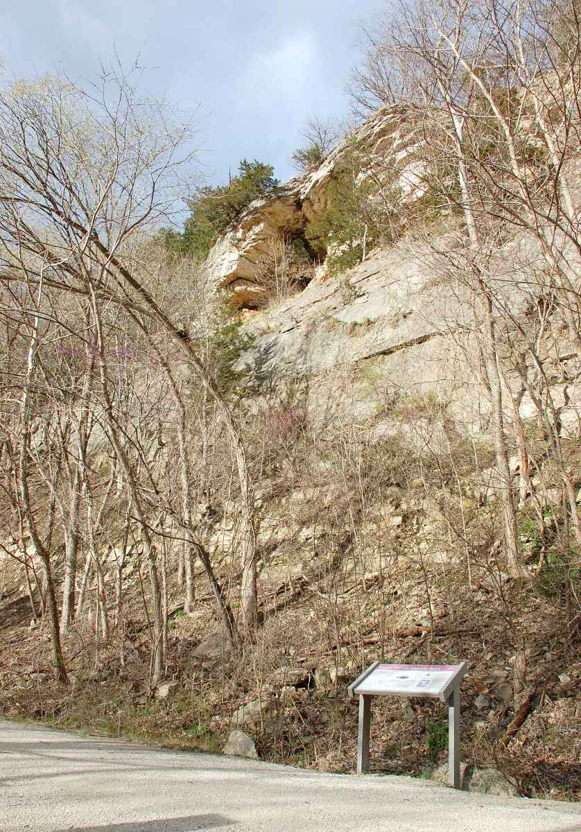
Photo by Jay Wilbur
NABSQNO 15S-550020-4300875. Roche Percee Natural Arch is a cave natural arch eroded through a bluff of Burlington limestone. The Missouri River once flowed under this bluff but abandoned it in recent history. The arch is located at mile marker 166.9 in Katy Trail State Park, about 7 miles southwest of Columbia, Missouri. The Providence trailhead provides the closest access point. As seen in the photo above, an interpretive sign is under the arch.
The earliest known documentation of Roche Percee Natural Arch is a map drawn by James Mackay in 1797, but it was a well known landmark to French traders travelling the Missouri River for many years prior to that date. Roche Percee is a corruption of the French for "pierced rock." On June 6, 1804, the arch is mentioned in several of the journals kept by members of the Lewis and Clark expedition. William Clark referred to it as "split rock." The arch remained a visible landmark for river travelers until 1878. Between that year and 1892, the bend of the Missouri River that passed under the arch migrated three miles to the south. The arch was no longer visible to travelers and it became forgotten. It is not mentioned in either the Beveridge or Vreeland catalogs. Roche Percee Natural Arch has a span of about 10 feet.
| Topo Map | Google Map | Return to State Index |