NABSQNO 14S-486700-4061680 (fallen)
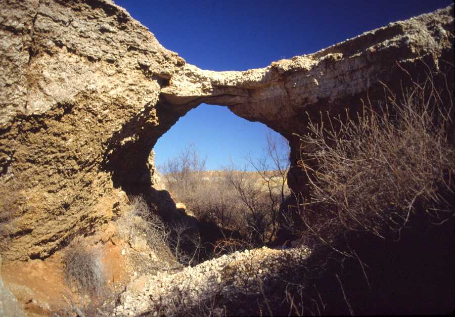
Alabaster Caverns Natural Bridge in Woodward County, Oklahoma
Photo by Jay Wilbur
NABSQNO 14S-486700-4061680 (fallen). Alabaster Caverns Natural Bridge was a waterfall natural bridge eroded through Blaine Formation gypsum by a tributary of Cedar Creek. It was located in Alabaster Caverns State Park, in Woodward County, Oklahoma. It is included as number 17-27 in the Vreeland catalog with a reported span of 22 feet. According to a park news release, it collapsed on April 29, 1992. Some have speculated that it was actually destroyed by park officials because it had become a safety hazard to park visitors, many of whom insisted upon walking over the bridge despite blockades and signs warning that it was extremely fragile.
| Topo Map | Google Map | Return to State Index |