NABSQNO 12S-610075-3885742 (f)
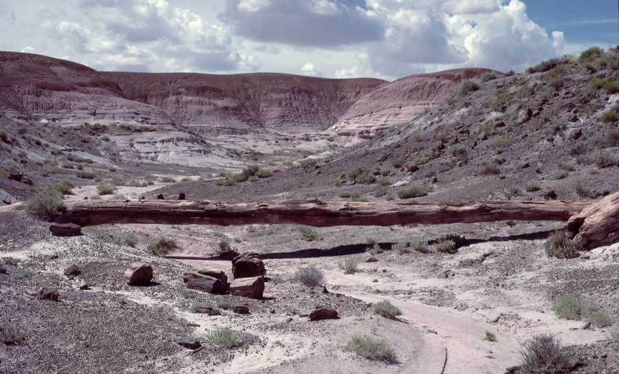
Onyx Bridge (pre-collapse) in Petrified Forest National Park, Arizona
Photo by Jay Wilbur
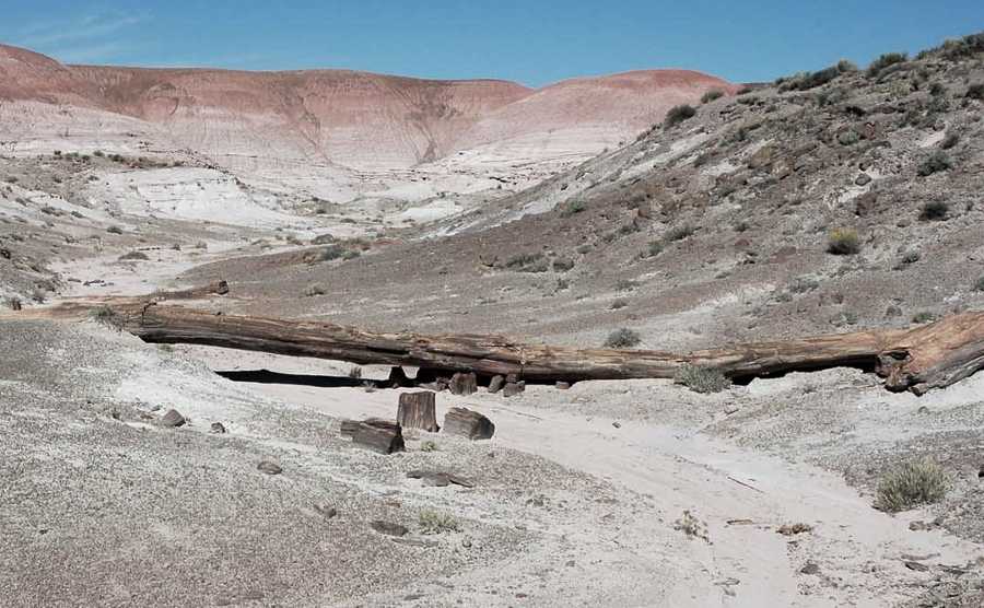
Onyx Bridge (post-collapse)
NPS file photo
NABSQNO 12S-610075-3885742 (f). Onyx Bridge was an outstanding example of the petrified log subclass of waterfall natural bridges. It was located in Petrified Forest National Park, in Apache County, Arizona.
Access to the partially collapsed arch requires an open desert hike that begins at the Painted Desert Inn. Only experienced desert hikers should attempt this hike. Also, please note that some USGS topographic maps of this area show Onyx Bridge at a wrong location about a third of a mile northeast of the true location. The USGS has (in October 2009) corrected the location of Onyx Bridge in its Geographic Names Information System, so hopefully future USGS maps will show it correctly. However, if you plan on visiting the remnants of Onyx Bridge, please use the location provided here and consult a Park ranger before you start.
Vreeland listed Onyx Bridge as number 11-20 in his catalog and reported a span of 38 feet.
| Topo Map | Google Map | Return to State Index |