NABSQNO 12S-681920-4316850
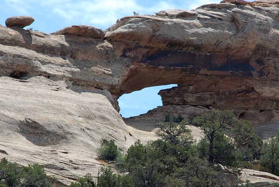
An unnamed shelter natural arch, Mesa County, Colorado
Photo by Jay Wilbur
NABSQNO 12S-681920-4316850. This unnamed shelter natural arch has eroded through a narrow ridge of Wingate sandstone. It is located about 9 miles west of Glade Park in Mesa County, Colorado. Both sides of the arch can be viewed from the DS Road. However, because the arch is on private land permission of the land owner is required for any closer access. This permission is not usually granted.
The distinctive shape of its opening has resulted in a plethora of names for this arch, including "Finger Arch," "Oklahoma Arch," and "The Frying Pan". None of these has been used consistently. The arch has a span of about 30 feet.
| Topo Map | Google Map | Return to State Index |