NABSQNO 14S-507800-4129470 (fallen)
 |
 |
|
| 1952 | undated | |
 |
 |
|
| 1960 | August 1961 | |
 |
 |
|
| September 1962 | 1970 |
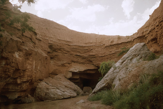
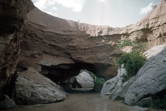
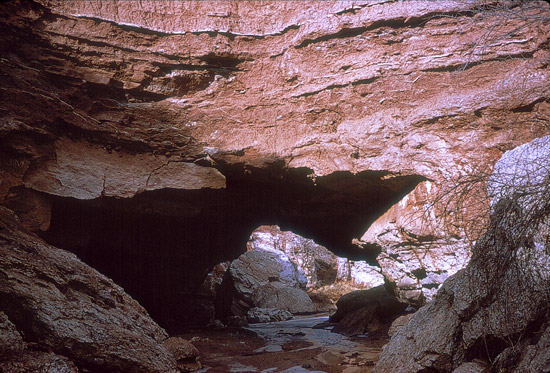
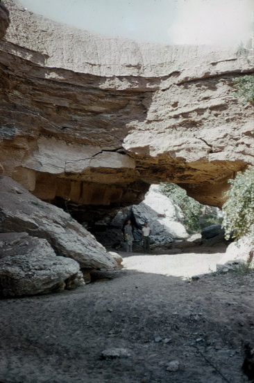
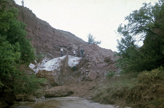
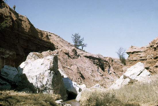
Red Hills Natural Bridge, Barber County, Kansas
Photos by Stan Roth, Courtesy of Kansas Geological Survey
NABSQNO 14S-507800-4129470 (fallen). Red Hills Natural Bridge was a waterfall natural bridge eroded by Bear Creek through layers of Blaine Formation gypsum and red shale. It was located on private property about 6 miles south of Sun City, Kansas in Barber County. Access to the site requires the permission of the current land owner. The arch has also been known as Barber County Natural Bridge.
Red Hills Natural Bridge has an interesting history of documentation. It was first studied by F. W. Cragin in 1896, who published the first measurements and geologic description, and then by G. P. Grimsley in 1899, who published the first known photo. John Jewett published new measurements in 1935, comparing them to Cragin's measurements taken 40 years earlier. He not only noted that the differences were dramatic, he indicated that "the bridge was observed to have changed noticeably between visits in May, 1933, and May, 1934." He stated that the primary purpose of his paper was to "record some dated measurements for future comparisons." The Kansas Geological Survey continued to doucment the evolution of the bridge until, and even after, its collapse in 1962. The series of photos above is from this historical record. Thus, the erosional lifecycle of Red Hills Natural Bridge is certainly one of the most studied and well documented of any natural arch.
A local legend about Red Hills Natural Bridge is that it was destroyed in 1962, by the land owner at that time, using dynamite. According to the story, his motivation was to prevent the acquisition of the parcel of his land that the bridge was on by the State of Kansas. Indeed, there were two attempts to do that via eminent domain in the 1940's and 1950's. The intent of the State was to create a park and tourist attraction centered on the natural bridge. Both efforts failed in the Kansas Legislature. Another motivation ascribed to the land owner to explain the destruction was his concern about liability issues resulting from the large number of uncontrolled visitors to the bridge.
Although entertaining, this story is almost certainly apocryphal. Also, the real story is far more interesting. A close examination of the sequence of photos above shows that a crack in the arch's keystone appeared and rapidly enlarged in the early 1960's. Thus, simple erosion undoubtably led to the natural collapse of the arch. It is also interesting to note that the red shale of the fallen lintel initially dammed the creek, but had cleared away by 1970. Many of the gypsum boulders evident in that photo have disintegrated and vanished since that time.
This arch was included by Vreeland in his catalog as number 23-143, although much of the information he provided is incorrect. The arch had a span of about 50 feet and a height of about 20 feet.
| Topo Map | Satellite Map | Return to State Index |