NABSQNO 13R-667137-3235331
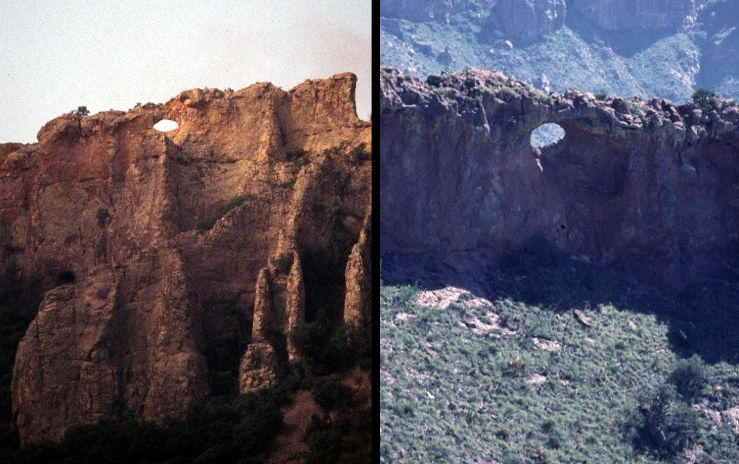
Southeast Rim Keyhole in Big Bend National Park, Texas
Photos by Jay Wilbur and Danny Horowitz
NABSQNO 13R-667137-3235331. Southeast Rim Keyhole is a shelter natural arch eroded through basalt. It has a span of about 20 feet and a height of about 10 feet. It is located on a highly eroded volcanic dike radiating from the Chisos Mountains in Big Bend National Park, Brewster County, Texas. Remote and very difficult to reach, it can be viewed in the distance from opposite sides from points on the South Rim and Lost Mine trails.
| Topo Map | Google Map | Return to State Index |