|
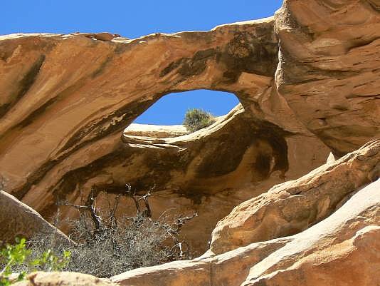
This arch cannot be seen from the route between the TH and the Doll House, that is, the Ernie’s Country Route. Hike east from the canyon containing Whitmore Arch, which is the Eastern Fork of Range Canyon. After about 0.6 miles of hiking east from the canyon containing Whitmore, you will see a side track leading to East Ernie Spring. To locate Ernie’s Skylight, backtrack about 800 ft. to the second narrow canyon to the north of the Ernie’s Country route. Climb up into this canyon to get a view of Ernie’s Skylight. The arch is about 300 ft. north of, and in the lip of Cedar Mesa SS from the viewpoint, which is at approximately UTM 12S 584160E, 4221098N WGS 84. You will probably want to use your GPS to locate this arch.
Photo and directions by Rob Jones |
