NABSQNO 13S-347867-3990535
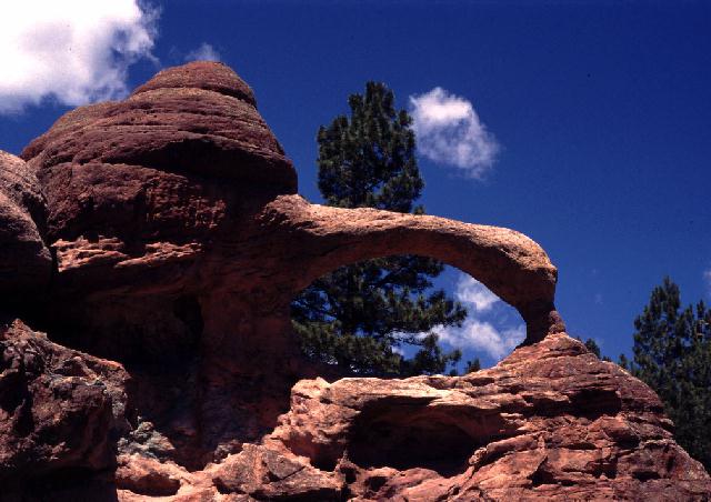
Teakettle Rock in Rio Arriba County, New Mexico
Photo by Jay Wilbur
Example Fin Natural Arch
NABSQNO 13S-347867-3990535. Teakettle Rock is a fin natural arch eroded through Cutler sandstone. It is hard to say at this point in the arch's lifecycle exactly what process was responsible for creating the opening, but it is clear that wall collapse was not involved. Although maturity attributes are not normally assigned to fin natural arches in the standard taxonomy, calling this arch old is justified. Not only is the specific process of erosion no longer evident, the lintel is very much reduced to a catenary shape.Teakettle Rock is located in Rio Puerco Valley in the Santa Fe National Forest, in Rio Arriba County, New Mexico. It is shown as "Teakettle Rock" on most maps of the area and is reached via about 14 miles of dirt roads from Coyote, New Mexico. Vreeland listed Teakettle Rock in his catalog as number 17-21 and reported a span of 12 feet.
| Topo Map | Google Map | State Index |
Other Fin Natural Arch examples:
| Full Moon Arch | Big Eye Arch | Top Story Window | Double-O Arch | Teakettle Rock |